Geological Survey of the Upper Rhine Valley Scan flights
Geothermal Energy from the Air: New Data for the Energy Transition
In Winter 2025/26, Vulcan Energy conducted a large-scale aerial survey in the central and northern Upper Rhine Valley. The aim was to gain a better understanding of the geological subsurface and to improve the planning of future geothermal projects.
The survey measured the Earth’s natural gravitational and magnetic fields. These data help to analyze the rock layers beneath the surface. For example, they make it possible to determine how permeable the rocks are or where specific rock types, such as volcanic rocks, are located. This is important to identify areas where geothermal energy can be used most effectively.
The measurement methods used are completely passive, they do not emit any radiation and are entirely safe for humans, animals, and the environment.




Questions & Answers
You have likely landed on this page because you were informed that an aircraft will be surveying an area in your region, and you may have some questions about this. We hope that the information provided here is helpful to you. If you cannot find what you are looking for, please feel free to contact us at seismik@v-er.eu.
The survey was carried out and managed by Bell Geospace.
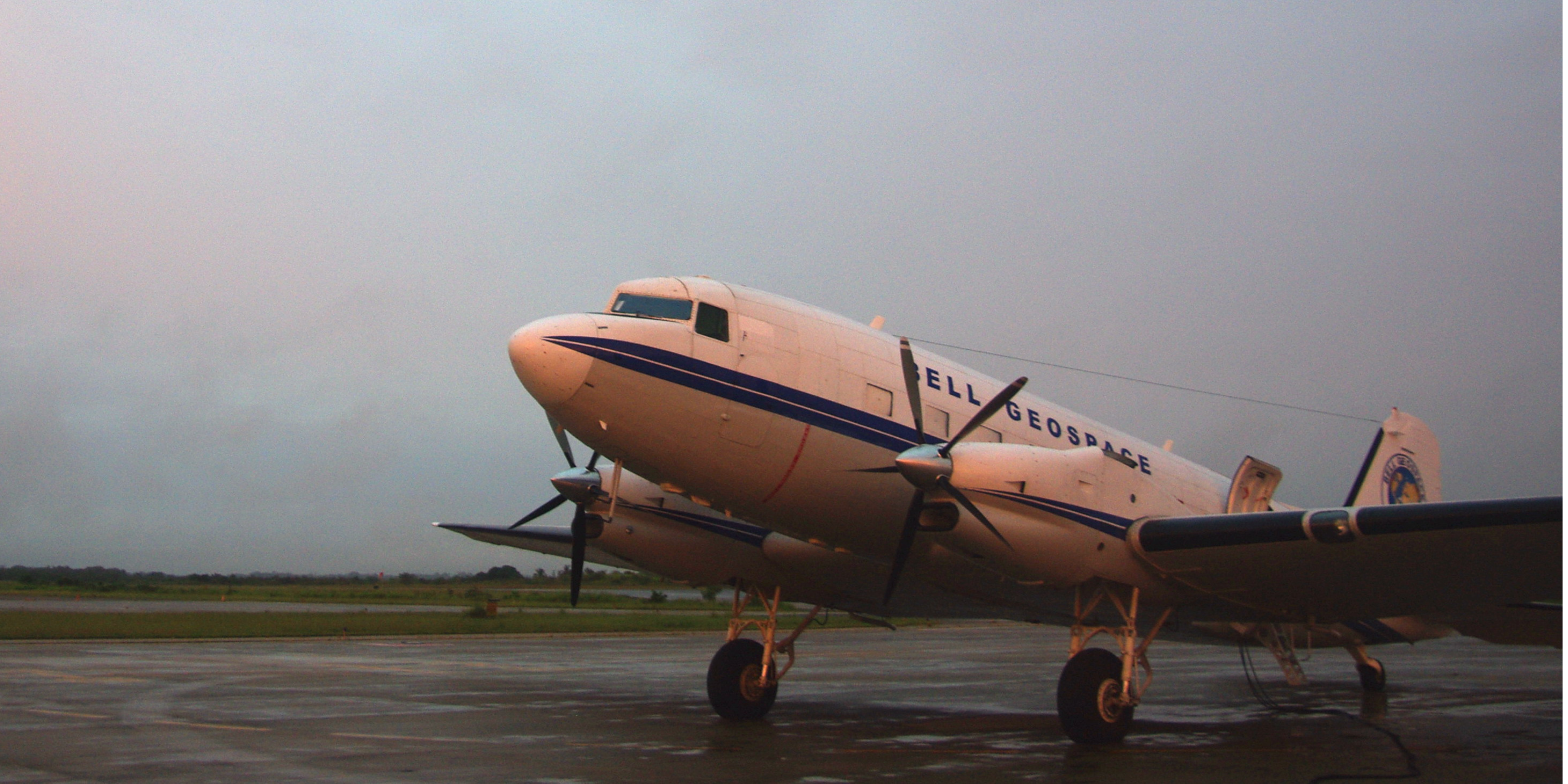
Bell Geospace is a British company based in Edinburgh (Scotland, UK). The company owns and operates three aircraft that have been specially modified for geological mapping. It has more than 25 years of experience in geophysical surveys across many countries and under a wide range of conditions. In this region, one aircraft (a Basler BT67) will be used for the survey.
The purpose of the survey was to collect geophysical information about the properties of the rocks beneath the Earth’s surface.
By carrying specialized technology on board, Bell Geospace’s aircraft is able to detect and measure geological features that are otherwise not visible. Essentially, it allows scientists to “see” through the Earth’s surface.
The survey measures the Earth’s natural gravitational and magnetic fields. These data help to analyze the rock layers beneath the surface. For example, they can be used to determine how permeable the rocks are or where specific rock types, such as volcanic rocks, are located. This is important for identifying areas where geothermal energy can be used most effectively.
We used measurements of the gravitational signal to detect variations in density.
We were looking for very small changes in the Earth’s density distribution in all directions (tensors) – this type of measurement is known as the Eötvös tensor.
The instrument used to collect the data is a gradiometer, roughly the size of an average washing machine. It contains a technology called accelerometers, which are also found in your mobile phone. The accelerometers were mounted on plates arranged at opposing angles and then placed within an umbrella-like structure to obtain the required measurements.
The flights were conducted during daylight hours, usually in the morning.
They typically began around 8:30 a.m. or shortly after sunrise. We expected to fly for up to five hours per day.
Flights might have also taken place on weekends and public holidays.
We anticipated staying in the region for two to three weeks in order to complete eight days of flying in suitable weather conditions.
Poor weather (strong winds, storms, cloud cover) may have caused delays, as well as unforeseen circumstances such as unannounced military exercises or unexpected wildlife/bird activity.
The survey is safe and a completely passive process.
Neither the technology on board the aircraft nor the aircraft itself emits signals or sound waves toward the ground.
The information is collected by measuring gravity and its variations (known as gradiometry). It is a fully passive process.
The Survey Area
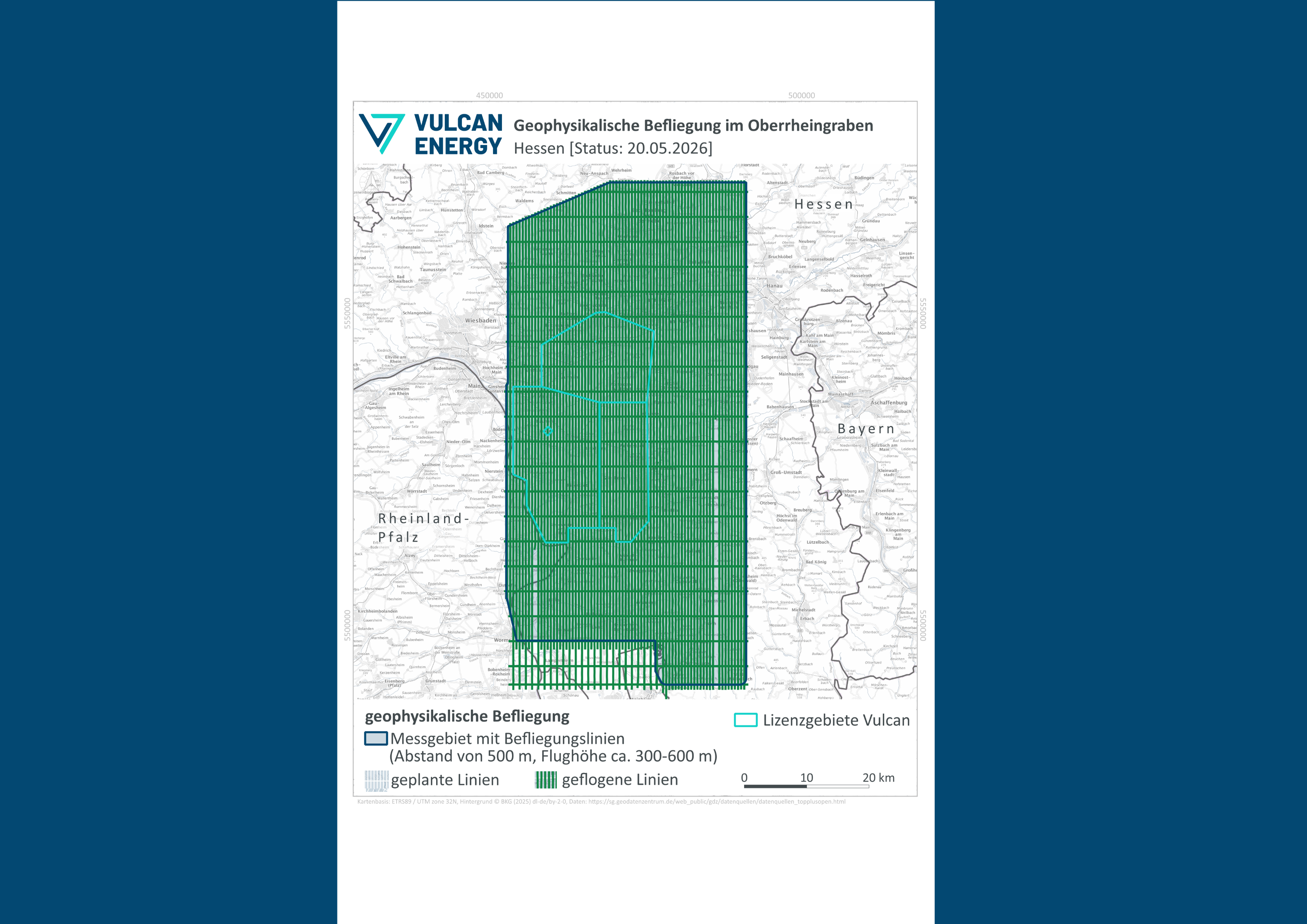
The map shown below displays the survey area. The measurement area is outlined in dark blue, while the flight lines that have already been completed are shown in dark green.
The Airplane
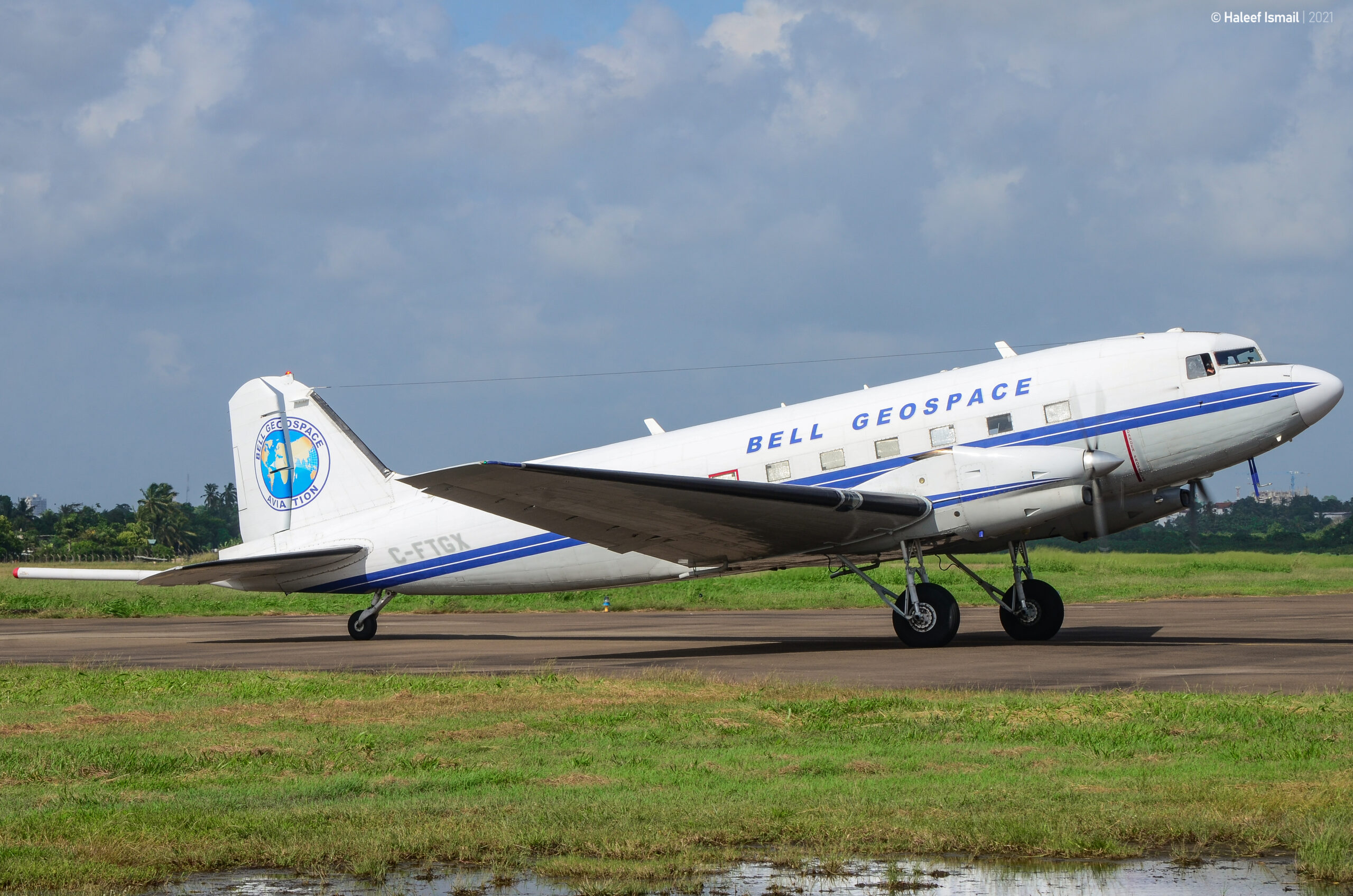
A “Basler BT-67” is used for the large-scale aerial survey of the Upper Rhine Graben.
Bell Geospace required an aircraft with two engines for additional safety, low sensitivity to turbulence for improved data quality, proven reliability, and good endurance for extended international range. The Basler BT-67 met these requirements.
The BT-67 is a converted DC-3 aircraft equipped with two turboprop engines and state-of-the-art digital avionics. It combines high productivity with logistical efficiency.
„Die Erhebung hochauflösender geophysikalischer Daten ist ein wichtiger Schritt, um das geologische Verständnis des Oberrheingrabens zu vertiefen. So schaffen wir die Basis für eine fundierte Planung zukünftiger Geothermie- und Rohstoffprojekte.“